Search

Rolf Rae-Hansen

Rolf's a freelance copywriter based in Edinburgh

Never Meet Your Heroes – Their Jerseys Will Do

The main inspiration behind The Breakaway was a desire to ride my bike up the high-mountain passes made famous by the Tour de France. The art of climbing by bike has always held me in its thrall. I was (still am) a skinny chap, and so riding uphill was my forte, or at least I was better at it than most of my cycling peers. There was also a rather famous compatriot over in France providing inspiration (to me and many others).

Millar in Polka Dots

Robert Millar is the only British rider ever to have won the Tour’s King of the Mountains polka-dot jersey, a feat he achieved in 1984. In 1989, I was a sixteen-year-old riding my bike at every available opportunity. Millar was by then a 30-year-old, highly successful pro on the Z-Peugeot team. That year he won the summit-finish-stage from Cauterets to Superbagnères (which also included the climbs of the Tourmalet, Aspin, and Peyresourde), and finished the race in tenth place overall. I was a new convert to the joys of Le Tour and watched events unfold through Channel 4’s half-hour highlights programme, gazing wide-eyed at an exotic, exciting world, where men did battle on high-mountains passes with names like D’Huez and Marie Blanque. And in amongst all that exoticism was a Scot, a man from my own country — entertaining, awesome to watch and utterly inspiring.

Millar was a great inspiration for a teenage boy to have. He was, and by all accounts still is, an enigmatic figure. He might have been Scottish but to me he was positively, exotically foreign. He didn’t seem to care what anyone thought of him, and rode with obvious passion and flare. His image certainly didn’t look out of place pinned to my bedroom wall with photos of the indie-music stars I was also idolising.

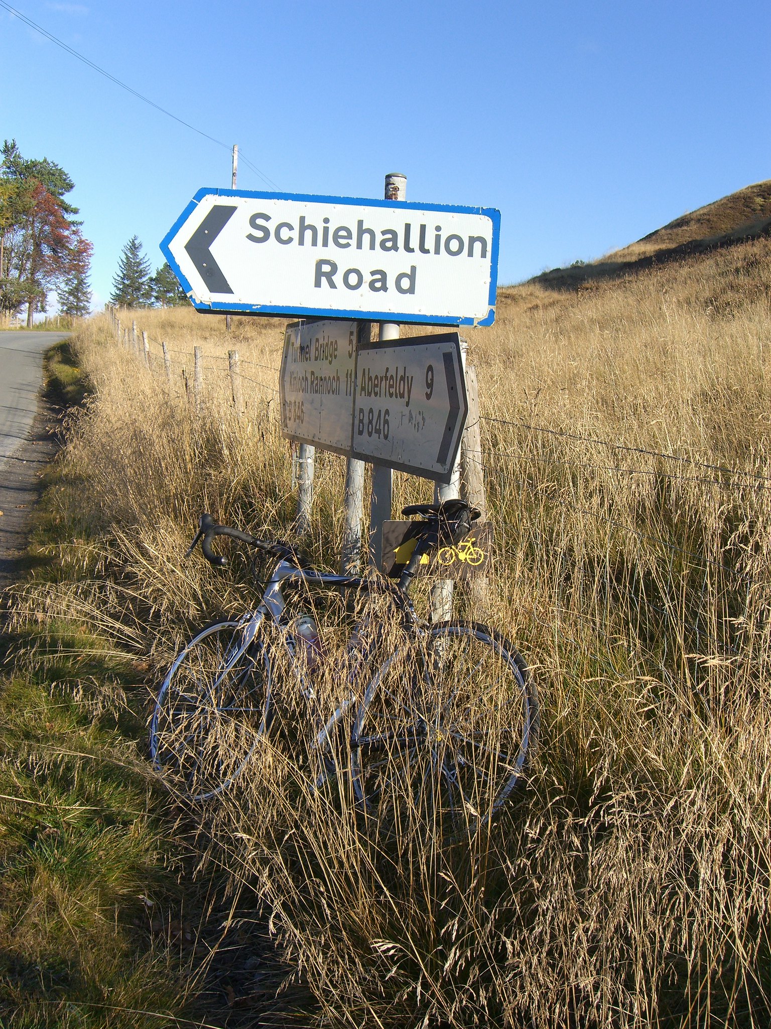
Fast forward a few too many years and I found myself in the Pyrenees, celebrating what I had haphazardly, and half-jokingly, labelled Robert Millar Day. My friend and I were about to ride to the top of Superbagneres and the Col de Peyresourde in tribute to Millar. It was 40 degrees. I had the shits. I suffered horribly. And somehow it all felt like a fitting tribute. Millar almost made riding up mountains look easy. The reality, as I painfully discovered, was otherwise (see the short extract from the book below), and my admiration for the man increased several notches.

Cooked at the Peyresourde

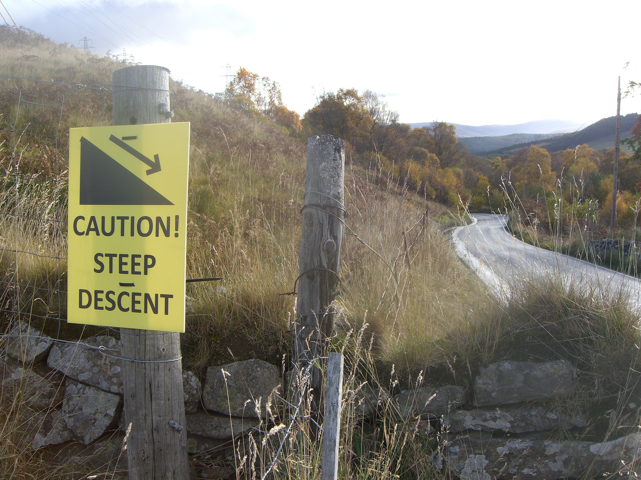
In the 1923 Tour, Robert Jacquinot collapsed into a ditch on the Peyresourde roadside, paying the price for the monstrous attacks he had made earlier in the day upon the Aubisque and the Tourmalet. In that ditch he is reported to have lain, entirely spent, only able to watch as those he’d left behind came pedalling by. I couldn’t help thinking, if collapsing into a ditch is good enough for a Tour rider then it’s definitely good enough for me. That desire to keel over was heightened by the sound of water, trickling and burbling away in the ditch to my left (quite what stopped me diving in I’ll never know). I guesstimated that there were probably around three miles left to ascend but from where I was supposed to find the energy for the next three hundred metres I hadn’t a clue. I looked up to the ever-distant summit; the water trickled and tempted; my mind wandered. It was the closest I had come all trip to getting off the bike and giving up, something I hadn’t seriously considered on any of the other climbs, not on the mighty Stelvio, not even during my awful ascent of the Madeleine. (It’s possible the knowledge that I didn’t even have the energy to walk was all that kept me on the bike.)

Then, last Sunday, I found myself in Billy Bilsland Cycles, having wandered in there on the way back from watching the British Road Race Championships at Glasgow Green. I was hoping they might display a few flyers for The Breakaway. Come in, they welcomed me like a prodigal son, and come and see Robert Millar’s jersey.

“Which jersey?” I asked.

“Which jersey?” They laughed. “There is only one.”
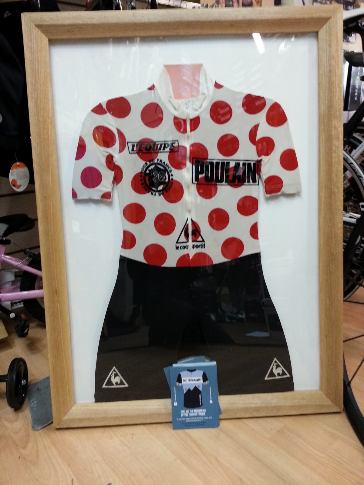
THE jersey

There it was, the polka dot jersey (in this case a skin suit) from 1984, worn by the man himself. This precious relic was a gift to Billy, the shop’s owner, a Scottish cycling legend and former international racer, who mentored the young Millar. (Apparently Billy — Mr Bilsland to me — is one of the few people still in touch with Millar.)

Given how reclusive the man is, meeting the jersey is the closest I’ll probably ever get to meeting Millar, and I kind of like it that way. They say you should never meet your heroes, in case they disappoint you (or you disappoint them). I’ll stick with the air of mystery, the memories of Tours watched on the small portable colour TV, the ardour and ecstasy (mostly ardour) of that Pyrenean day spent riding in Millar’s wheel tracks.

To buy a copy of The Breakaway click here.

Billy Bilsland Cycles are at 176 Saltmarket, Glasgow. 0141 552 0841 www.billybilslandcycles.co.uk

The Breakaway – A Personal Piece of Tour History


One notion that I took away from the travels behind the story of The Breakaway was a sense that the climbs we had tackled were essentially the exact same roads the Tour peloton had been riding since the race first tackled the high mountains over one hundred years ago. The road surfaces had improved (tarmac laid onto the mud tracks of those pioneering days) but in essence the Col du Tourmalet I huffed and puffed my way up was the same that created the legend of Eugène Christophe in 1913, the same over which my hero Robert Millar led the race in 1989 (en route to stage victory at Superbagnères). Many of the climbs that the race will tackle this July will be the same sweet and savage roads I was lucky enough to ride during my own tour of France.

On Saturday 29th of June the peloton will roll out of Porto-Vecchio on the island of Corsica for the start of the 100th Tour de France. Whilst a sprinter, such as Mark Cavendish or Peter Sagan, is likely to don the first yellow jersey, it will be in the mainland’s high mountains that the race overall is decided.


Continue reading “The Breakaway – A Personal Piece of Tour History”

Learning to Ride

Big Person, Small Person

Yesterday I had the privilege and pleasure of being on hand for my niece Edie’s inaugural bike ride. The tiny balance bike had been our gift for her second birthday but we’d had to wait a couple of months for suitable weather and, more importantly, for her legs to grow sufficiently so that her feet could reach the ground when she sat in the saddle. Continue reading “Learning to Ride”

It’s a Stelvio No-Go

Stage 19 of the 2013 Giro d’Italia is scheduled to tackle The Stelvio but it appears that Madre Natura has other plans. With the pass blocked by snow, and more forecast to fall, (at the time of writing this blog) race organisers look set to remove the climb from the day’s route. You can check out the current summit conditions for yourself by viewing the Stelvio webcam here. Continue reading “It’s a Stelvio No-Go”

The Giro d’Francia?


On Sunday 19th of May, stage 15 of the 2013 Giro d’Italia will make a foray into the French Alps. The race was scheduled to tackle two climbs up which I soared (or was it suffered?) as part of my adventures in The Breakaway: Mont Cenis and the Col du Galibier. However, as of Saturday the 18th it appeared that heavy summit-snow and a risk of avalanches had resulted in both these climbs being withdrawn from the day’s itinerary.
Had these climbs still been included then hopefully none of the riders in the Giro would have been as confused as I was by Cenis, nor as challenged by the Galibier.

Continue reading “The Giro d’Francia?”

The Breakaway … and the Giro d’Italia too.

… and the Giro too

Okay, okay, so the title says it’s all about the mountains of the Tour de France. Well, truth is, the travels (and travails) of The Breakaway actually kicked off in Italy.

Our first five days took in the Dolomites and Italian Alps, climbs that were breathtaking to look at and ride, passes infused by decades’ of myth and tifosi passion. My first experience of riding in Italy was unforgettable, but so tough that it nearly ended out trip before it had properly begun.

Lake Garda Goonie

We were turned to Goonies by the darkness of Lake Garda’s unlit tunnels, almost eaten alive by Dolomiti billy goats, truly humbled by the Stelvio, its innumerable switchbacks and silver-haired Shaolin monks.

Stelvio Switchbacks

The Tour is indisputably the biggest race but the Giro d’Italia is every bit as inspiring. Could it be the fans’ passion, the Italian flair for style and drama, the azure seas and skies? It’s all that and a whole load of truly immense mountains that make the Giro what it is. Unmissable.

Loch Rannoch Ride – A Taste of Etape Caledonia


The Etape Caledonia, (the 2013 edition of which takes place on the 12th of May), was the UK’s first closed road cycling sportive. The event, part of the Highland-Perthshire Cycling Festival, has proved a roaring success and introduced the region to cyclists from across the UK. 

My personal Perthshire discovery came by way of seeking a ride to interrupt the car journey from Edinburgh, up the A9 and into the Highlands. What I discovered, and what thousands of others can already attest to, is some of the best cycling you’ll find anywhere in the world.


My ride mimicked – but reversed – much of the Etape’s middle section, looping out and around Loch Rannoch. However, instead of Pitlochry, my mini-adventure started and finished in the small market town of Aberfeldy.

I parked up on Taybridge Drive, by the banks of the River Tay and beneath the shadow of an imposing

Black Watch Memorial

memorial to the historic Black Watch regiment. (The parking there is free and the adjacent putting green’s public toilet is open March to October.)


All wrapped up against the elements (the dashboard thermometer read 1-degree C) I headed over General Wade’s bridge, built in 1733 and still going strong. The hump-back hurled me down and onto the B846, which swept left through the village of Weem and on passed the 16thcentury Castle Menzies. There are coffee, cakes and sarnies on sale at the adjacent House of Menzies but it was a little too early in my ride for a pit stop.

For first five miles, the road was mostly flat, an opportunity to spin the pedals and get some blood flowing to my icy-numb extremities. If there had been any doubt as to the route’s arduous prospect then a look up ahead proved conclusive. The mountains reared imperious, the road pointed ominously toward them.

Far From Dull
I rolled passed the village of Dull (twinned with Boring, in Oregon) and through the poetically named Coshieville– the point on this ride where, if you don’t like climbs, semi-deserted roads and jaw-dropping views, you should turn around and head for home.

The climb commenced with twists and turns through dense woodland. I heard the splashing water of nearby falls and was minded of past Pyrenean forays. Although a decent test, I was only in fifth gear on a compact chainset, spinning nicely, holding energy in reserve for the 50-odd miles to come.

When the road rose above the tree line, the mountains were back in view, and seemingly bigger than ever. I shifted to reminiscing about Italian Dolomites: the tarmac tilted steeply skyward like a mini Marmolada, in my face and taunting.

Those initial ascents were eased by the knowledge that my chosen route would, eventually, come back down the same way, an extremely fast descent as the gain from all that pain.

The left turn along Schiehallion Road signaled the end of the climb and came as a blessing to tired and

Schiehallion Road

tightening legs.


That single-track-saviour is so-named because it skirts the base of the mountain, Schiehallion. A Munro at 3,547 feet, it’s extremely popular with walkers. It’s also the site of Charles Mason’s pioneering 1774 experiment that attempted to estimate the mass of the Earth. The result: heavy, man.

Whilst there were mountains on my left-hand side, on my right there was open space, soon to be filled with water–little Loch Kinardochy as prelude to the larger Dunalastair Reservoir and then mighty Loch Rannoch itself.

Car-Free Roads
From there the road’s profile formed a gentle, undulating wave. The hardest part was stopping myself from constantly stopping to gawp at the view, and to be aware of oncoming traffic–a too close encounter with a road-hogging refuse lorry nearly turned me to trash.

By Inverhadden, at about the 17-mile mark, I crossed the burn and kept left. (A right-turn there leads to Kinloch Rannoch, ideal for a pit stop or for reducing the route to a 40-miler – don’t, you’ll miss the best of the scenery.)

The unmarked road further narrowed, Loch Rannoch opened up on the right and I was back to being distracted. The huge swathe of water sparkled azure, exotic against the mountains’ brown, green and autumn-russet backdrop.

In the big ring, I cruised by houses with big glass frontages that allowed their residents to greedily grab the view. I dreamily imagined waking up to that scenery and turned evergreen with envy.

By Finnart, I was nearing the westerly end of the Loch and my ride’s mid-point, the hydro power station directly across the water, its massive pipes running down the mountain to harness nature’s power. My own energy had ebbed, so I made sure to eat and drink, filling up for the return leg round the other side of the water.

Arty View
That turn came just after Bridge of Gaur with a right to rejoin the B846. The left-hand fork leads to Rannoch Station where, as the sign warned, the road ends (as does the rail line connecting to Fort William, Glasgow and beyond). From that point on there’s nothing but vast uninterrupted swathes of truly unspoiled wilderness.

Back on the road and it was more of the softly undulating stuff I’d enjoyed on the opposite shore. Again the views were amazing, perhaps even better. I could now clearly see the mountains, and Schiehallion in

Schiehallion in the Distance

particular. Sometimes referred to as the centre of Scotland, I had a definite sense that my ride was revolving around its giant, conical peak.


The peace was also a joy to behold, especially for a city type like me, my ride sound-tracked by little more than the wind on water, the hum of tyres on tarmac, bird calls and the bucolic clucking of hens.

Kinloch Rannoch
After 40 miles I’d reached Kinloch Rannoch. The village offered a couple of options for food and caffeine refuelling but I was keen to follow the signpost, keep on the B846 and head for Aberfeldy. I could smell snow on the air, see the skies darkening and feel that the temperature had further dropped.

The road was still undulating but each consecutive rise seemed to be longer and steeper than the one before. I clicked down through the gears, back to munching energy bars as the road climbed some more before rolling down and into Tummel Bridge.

I remained on the B846 (navigationally, this route is a doddle) rolled over the old bridge (another of General Wade’s crossings), too weary for sightseeing. By then the snow I’d smelled had started to fall, no more than flurries but sufficient to keep thoughts on the flask of coffee in the car at Aberfeldy.

Whereas that initial climb out of Coshieville was probably the second hardest part of this route, the first was now definitely upon me, and no mere undulations.

The next rise hurt but I got over it okay. Then came another. It hurt more and I fared less well, the accumulated fatigue taking additional toll. The road surface – one of those heavy, Scottish energy-sapping sorts – didn’t help matters. By the next rise I was out the saddle and almost at a standstill.

My eyes, dragged from the view, were now locked to the odometer’s digital display, dizzy brain wondering why all my effort failed to add digits to the tally.

Eventually, the last rise was crested. I swigged from the dregs in my bidon and flew downhill, passed that 
Steep Equals Fast Equals Good
turn to Schiehallion Road, for a descent truly earned and thoroughly enjoyed.

I swept round the bends, out through Coshieville and landed back on the road to Aberfeldy. A few miles in which to warm down, a last heave over the hump in Wade’s old bridge, and I was back at the car with my coffee.

Strava Sucker

For the uninitiated, Strava is an app used by cyclists (and runners) to log their activity. Whilst you pedal it creates a map of your route, and compiles data on distance, time, average speed, altitude gained, etc.
Whether you like it or not, Strava also takes your time taken to ride “segments” (specific sections of road or their website, from there you can, “see where you rank and start moving up the leaderboards.”
Strava Sucker
A Strava Sucker in Action

trail) and then compares your results against other cyclists who’ve ridden that same segment. As they say on

I added Strava to my phone’s apps late last year, mainly too see what all the fuss was about. A few uses and, although I liked that it generated a share-able map of my ride, the skeptic in me erred toward seeing it as little more than a way for show-offs to do a bit more showing off, the chance to turn every mundane rise in the road into a virtual race. The pessimist in me also began to worry about my lack of fitness.

I began to wonder if the virtual race I’d taken part in might be fixed — some of the climbs I had battled up at an average speed of around 10mph were showing Strava “King of the Mountain” highest speeds of around 30mph, a velocity my car would have struggled to achieve on those same roads.
As a result of that skepticism I only used Strava intermittently and paid little heed to where I ranked on the leaderboard for segments covered by my regular Edinburgh-based rides.
However, it was during a recent trip up to Moray in the north east of Scotland that I slipped from being Strava doubter toward becoming a Strava sucker.
I had used the app to record a short route that I’ve ridden on and off for decades, mainly so that I could get an idea of how much altitude the main climb gained over its 2 miles (actually, Strava says it’s 1.8 miles, so there). Much to ego’s delight, I checked the results post-ride to discover that I’d achieved a King of the Mountains best time.
I had truly grovelled up the climb, battling a headwind, not a thought to how fast I was travelling, too much in oxygen debt even to recall that Strava was recording the slog. Definitely not a glory performance but still, Strava had reeled me in.
Two days later and I had time for one last bike ride before heading back to Edinburgh. But which route should I take? Ego decided: ride the same route, try and better my previous time on the climb.
So there I was, back to battling gravity and that headwind, mind now swirling with thoughts of the glory I’d derive from smashing my old “record”. Each time my legs politely demanded a lower gear I was up and out the saddle, forcing the tempo a little higher, turning myself inside out, and all for the sake of Strava.
Oh dear, what a sucker.

Edinburgh to Edinburgh via East & Mid Lothian

Distance: 47.5 miles (scroll down for the Strava map)
Less then 48 hours until the clocks spring forward for the start of Summer Time and I’m staring out the window, wondering if the snow is sufficiently heavy for my bike ride to be cancelled. I put the coffee machine on, decided to wait and see how the weather developed. Half an hour and two very strong coffees later, I’m on the road, the snow’s stopped, the sun’s out but the skies on the horizon are dark and doom-laden.
Nevermind, at least I’m out. That was probably the hardest part of this ride, breaking that imaginary barrier, overcoming my meteorological doubts and exiting the flat. (How much improved as a cyclist would I be had the hours of weather watching and dithering instead been spent on the bike and riding?) Anything can happen now that I’m actually out, on the road and pedaling — rain, snow, lightning, storm of locusts, zombie invasion — it would only help to embellish the tales I’d tell when safely back in the flat, returned to staring out the window at the weather.
I headed out through town, away from the canal, up through Bruntsfield, across the Meadows, into Holyrood Park and on toward Meadowbank. I was in a contemplative mood and so paid sufficient attention to realise just how pretty a city Edinburgh is. In five minutes I was treated to stunning scenes of the Georgian skyline presided over by the Castle, the imposing crags of Arthurs Seat, then down the hill passed Parliament and Palace. I’d have taken some photos but removing my gloves put me at risk of frostbite and I kept thinking: I see this every day; I’ll take some photos another time.
Portobello Prom
Portie Prom
Passed Meadowbank with its stadium and dilapidated Velodrome, I rolled on down toward Portobello (a separate seaside town that’s become subsumed by the city). Rather than battle the traffic through the town I chose to meander along the prom’, dodging joggers and excited dogs, struggling to resist the aromas of fried food and coffee that leaked from the many cafés.

The twin towers of Cockenzie power station (in the direction I was headed) looked minutely distant. I’ll be there in no time, I thought, still under the influence of my morning coffees.

Out through Joppa, I turned left and long the coast road, through Musselburgh (the poor man’s Portobello), passed the race course and left toward Prestonpans (named after its salt-panning origins). That stretch, which should have been a scenic warm-up, was proving a tougher task, the wind against me, keeping those twin towers distressingly distant.
Eventually out through the Pans (as the locals call it) and I stopped to snap a photo of the power station and its chimneys. (I also took the gloveless opportunity to fish an energy bar from my back pocket.) The ugly-yet-imposing place really is a local landmark. I wondered what would happen to it now that the facility had been decommissioned, taken off-grid. Would it be listed, turned into a residential and leisure development like London’s Battersea? Or left to rot, crumble and, eventually, tumble?
Cockenzie Power Station
I battled on, through Cockenzie and Port Seton, the road still following the coast but ducking into tree-filled stretches that provided a little shelter from the wind. As that cover fell away my time came to turn inland, away from the coast and into Longniddry.
The road into the village passed the impressive arched gateway to the Wemyss Estate with it’s carved motto: je pense forward. I thought and rode straight ahead — then turned right, through the village, before a left, under the railway line and on into open countryside (headed toward Pentcaitland).
My views until then had been mostly blue sky and sea. The coastline behind me, I now had dark skies, barren fields and snow-covered hills for encouragement and entertainment. It looked daunting: I reached into my back pocket for another energy bar. Je pense forward.
When I got there, Pentcaitland was a pretty little place, a stone’s throw from Scotland’s capital city but looking and feeling thoroughly rural. I stayed on the narrow road through the village (resisting the urge to stop and investigate a sign that offered “hot drinks & hot food”), crossing the River Tyne (no, not the River Tyne) following the directions for Dalkeith.
The road was now undulating nicely and the wind wasn’t making much impression. It had, however, started to snow and the skies ahead were blacker than the tarmac along which I was rolling. I was in the mood for thinking backward, to the blue sea and sky I recently departed.
After a few miles I took the left turn to Pathhead, onto a less amenable road. Within a few minutes of the turn, the snow had stopped and the sun was out. I unzipped my jacket and swigged from my bidon, gone from stressing about being under-dressed to wondering if I might have worn a layer too many.
Mur de Ford
Mur de Ford
Through Pathhead I took the left turn to Ford, noticing a signpost that warned of a 12% gradient. Doesn’t bother me, I thought, as I freewheeled downhill, before reaching the bottom and remembering that what goes down must come up (unless of course you want to ditch the bike and start a new life at the bottom of the hill).

The Mur de Ford, as it shall henceforth be known, was the first real ascent of the day and my legs failed to show any signs of appreciation.

At the top of the Mur was a left turn to Gorebridge (once a mining village, now a former mining-village, like many outposts in this part of the world). Through Gorebridge and I followed the signs for Penicuik. The landscape had opened out again to reveal those snow-covered hills, now looking much more like snow-covered mountains. Time for another energy bar.
Either the energy bar was an extra special specimen or the wind was behind me, for I took the next few miles in my stride, turned left just before the village of Temple and on through the wooded valley to Carrington (the least Dynasty place on the planet). You can tell you’re short of fuel on a ride when a farm’s hand-painted sign selling free-range eggs makes your stomach rumble. 
Carrington Church
Carrington Church

That’s what happened, so I sat in the sun outside Carrington’s 18th century church (now a design studio) and munched another bar.

Up the wee rise and out of Carrington and I was back on more familiar roads, the sight of those not-so-distant snowy mountains (the Pentlands) no longer delivering dread. All I had to do was drop down the hill into Roslin Glen, climb up the other side and I’d be (almost) home. The 16% gradient of that climb took me down into third gear and forced out a rather tired sigh but was soon over and done with. I turned left (away from the village and the chapel made famous by The Da Vinci Code) and onto the main Edinburgh Road.
Roslin Glen
You’ve Been Warned

I kept it in the big ring all the way home from there — although, it took a few jelly babies from my emergency rations, and a good deal of Thomas Voeckler face-pulling on the last climb (up to Fairmilehead) to do so.
Downhill all the way from there. Back to the flat for a bacon butty, hot, sweet lapsang souchong and an even hotter bath. My last winter bike ride was behind me, if only I could have said the same for the winter weather.
There’s a full map of the route here on Strava.
Click here to view all the photos on Flickr.

Blog at WordPress.com.

Up ↑